There Goes Your Entire Day: GeoGuessr

If you weren't connected to the correct Twitter tubes this weekend, there's a chance you may not have spent every waking moment playing GeoGuessr. So let's put that right now.
Anton Wallén's clever repurposing of Google's Street View magics dumps you in the middle of somewhere, and you have to try to figure out where that is. You can move around in Street View as you might expect, but obviously you can't zoom out to see the map you're in. Once you've wandered about, hunted down clues to a location, and feel pretty sure of where you are, you drop a pin somewhere in the world on the map top right, and you score points based on how close you were. And then you keep doing that until you've forgotten to go to bed tomorrow night.

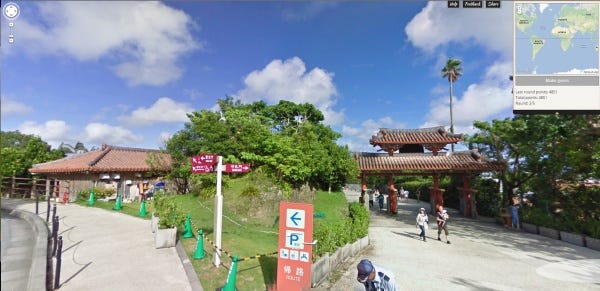
What's so fun about it is the sense of a successful deduction. You may well find yourself in the middle of a forest, or quite frequently in the endless stretches of a desert. But there are clues to be found pretty quickly. Vegetation is one, but road signs are another. Road markings themselves can often give away at least a continent. You may be pretty certain you're in the United States Mid-West, but then the Chinese characters on what looks like a parking sign tend to point you away from that theory.
Another time you may be in a busy street, and the language is going to be easy to find. But if it's an unfamiliar language, and despite searching you can't find any useful roadsigns pointing to nearby towns you may recognise, a neat trick is reading the advertising. The URLs will at least help you out with the specific country, but spotting a town name that appears on many of them can be a big hint. So you've figured out you're in Poland, but now you know you're in the region of a big town, Konin. Narrowing it down further is going to require more exploration, spotting more subtle details, or - you know - bumping into a sign with the name of the town on it. So, for instance, that image above - turn around and head around a corner and there's this:

Which is a start... My guess is Scandinavian? I think Sweden.
Heading down the road for more clues I had a real moment of cognitive dissonance. Having spent far too much of my time playing Neverwinter recently, seeing a noticeboard by the side of the road seemingly covered in sparkles bemused me. Here:
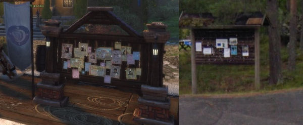
Does this mean the locals create quests for each other and post them here? I really hope so. Then, bingo:

Indeed Sweden. And a quick scour of the map top right and I find Umeå, and from the distances I can make an educated guess as to where I am. That's how I play, at least.

Geography has always been an enormous weakpoint for me, so I'm both surprised to learn what I do know, and further humiliated to reveal what I don't. Discovering I'm in South America generally means embarrassment is ahead. And those desert roads can often lead to a wild guess, sometimes tens of thousands of kilometres out as it turns out that yet again this stretch of Nevada is in the West of Australia.
There are five turns in each round, scoring you points based on how far out your guesses are. And my results tend to be a mix of surprisingly close and woefully far apart:

But it's a real joy to just stumble upon amazing sights. Highlights for me have been:


It both demonstrates what an extraordinary endeavour Street Maps is, and indeed what a lovely implementation of its ideas this is. As the game says, let's explore the world!